Interactive BLM Rangeland Health Geospatial Data Portal
The Bureau of Land Management administers more 245 million acres of public land, which is more than any other federal agency. There are 155 million acres of leased grazing allotments. PEER has created a visual compilation of the agency’s data on the rangeland health of each allotment.
Through multiple public record requests, PEER gathered the agency’s data from each state and every field office. PEER plotted the data from 21,000 allotments on one interactive map.

Rangeland health – or Land Health Standards (LHS) – refers to the quality and sustainability of waterways, habitats, soil, flora and fauna on the range (43 CFR §§ 4180.1, 4180.2). Many factors impact rangeland health– off road vehicles, drought, the spread of invasive species and fire. However, BLM identifies livestock grazing as the most frequently cited cause of range failure.
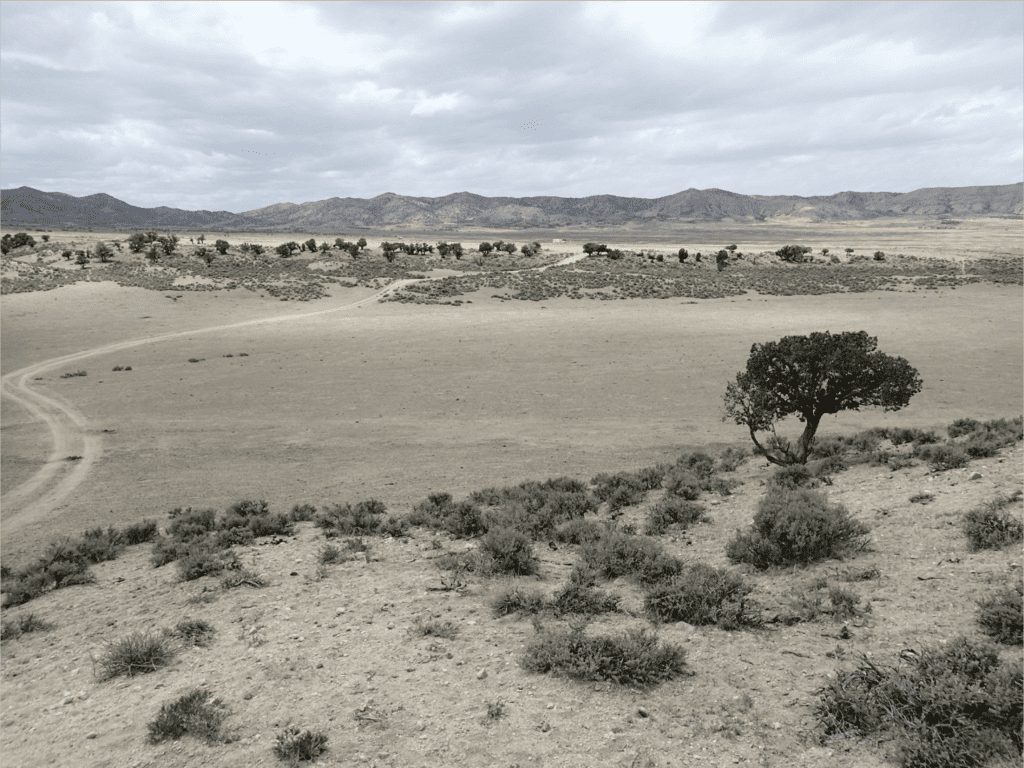
STORY MAP
Agency Field Data Reveals The Impacts of Grazing
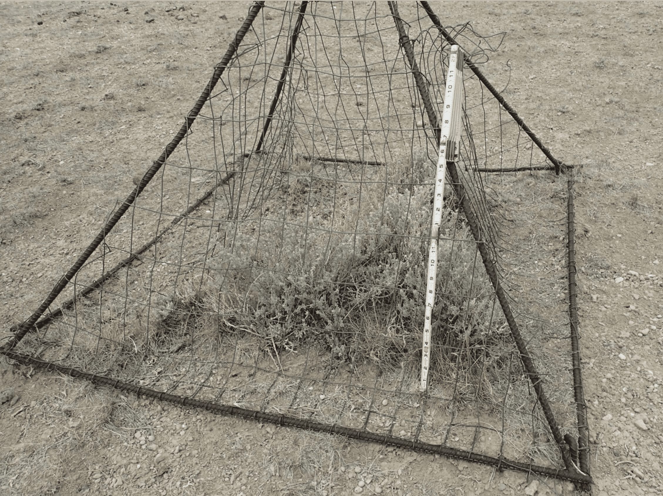
BLM Rangeland Health Map User Guide
1. What is the BLM Rangeland Health Geospatial Data Portal?
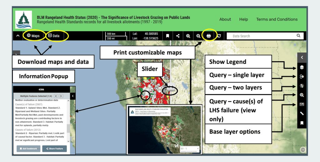
PEER’s interactive map Portal contains BLM’s most current land health standards status for 21,000 allotments containing 155,000,000 acres of public lands, and a number of useful GIS layers for visualization, exploration, exploratory analysis, and download.
2. How do I access the PEER interactive map portal?
- Go to http://mgo.ms/s/ks512
- The map portal is publicly accessible, and no login is required
- Please read the Disclaimer
3. What kinds of information can be asked of the data?
It contains simple, useful GIS capabilities that can help ask and answer complex questions such as
- How many allotments fail land health standards due to livestock grazing in Wyoming?
- Are there regional differences in the reported significance of livestock grazing as a cause of failure to achieve land health?
- What percentage of area assessed to date within the Central Basin and Range ecoregion fails land health standards where current livestock grazing was a factor?
- How many acres of BLM lands within the Greater Sage-grouse Management Zone IV are recorded as failing to meet rangeland health standards due to livestock? Within the Grand Staircase-Escalante National Monument? Within Wild Horse Herd Management Areas in Nevada? Within a Field Office?
- How many allotments that are identified as having met all land health standards during the most recent Land Health Standards evaluation fell into the Management Category “IMPROVE” in 2021? Where do they tend to be?
- How many allotments in Oregon that failed standards but had not recorded a cause in the most recent dataset received (through 2019) identified livestock as a cause of failure in the last dataset received from BLM in 2014 (assessments through 2012)? In the first dataset with records through 2007?
- How many allotments identify livestock as a cause of failure at least partially within a Wild Horse Herd Management Area?
- How long do the queries take? Depending on the number of features, the area queried, and the complexity of the queries, up to several minutes. If you receive a message that states that the query is too complex, try selecting a specific area using a bounding box.
4. What types of data are available on the PEER interactive map portal?
PEER’s interactive map Portal contains BLM’s most current allotment land health standards status and a number of useful GIS layers for exploration, analysis, and download. These include:
- The significance of livestock grazing as a cause of failure by Level III Ecoregion (area failing due to livestock of total assessed area). Note: allotments along boundaries are often split)
- Allotments with Selective Management Category in 2021 (IMPROVE, MAINTAIN, and CUSTODIAL)
- Greater Sage-grouse Primary Habitat Management Areas
- Greater Sage-grouse General Habitat Management Areas
- Greater Sage-grouse Management Zones
- Greater Sage-grouse Breeding Bird Density
- Wild Horse Herd Management Areas (HMAs)
- Wilderness areas
- Wilderness Study Areas
- National Conservation Areas
- National monuments
- Areas of Critical Environmental Concern
- Allotments identified by USGS as failing due to livestock by USGS using the first dataset obtained through the Freedom of Information Act in 2008 (records through 2007). (This represents the only data that have been examined by BLM to date)
- Level III Ecoregions
- The Cold Deserts Level II Ecoregion (contains the highest levels of allotment area failing where livestock grazing was identified as a significant cause)
- Ecosystem Resistance & Resilience
- BLM’s Assessment, Inventory, and Monitoring TerrADat terrestrial sampling plots
- BLM’s Assessment, Inventory, and Monitoring AquADat Lotic sampling areas
- A recent U.S. Drought Monitor Map (9/28/2021)
5.What features are available on the PEER interactive map portal?
- Visual exploration of any combination of map layers
- Multiple base maps, including satellite imagery and topographic layers to optimize viewing
- Simple searches for key words within any of the datasets (invasive species, wildfire, allotment number, field office number, etc.
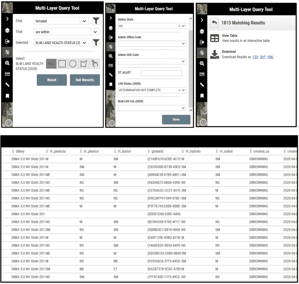
- Queries of multiple attributes (state, LHS status, field office, …) with a single layer
- Queries between two layers where they overlap (e.g., allotments that have yet to have a land health standards evaluation since the program began in 1997 within the Northern Basin and Range Level III ecoregion)
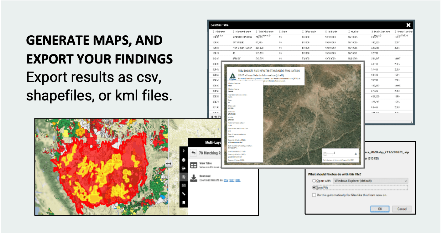
- Examination of query results as a table, or downloaded as a csv file, GIS shapefile, or a kml file
- Customizable and downloadable maps
6. Conducting Queries and Searches
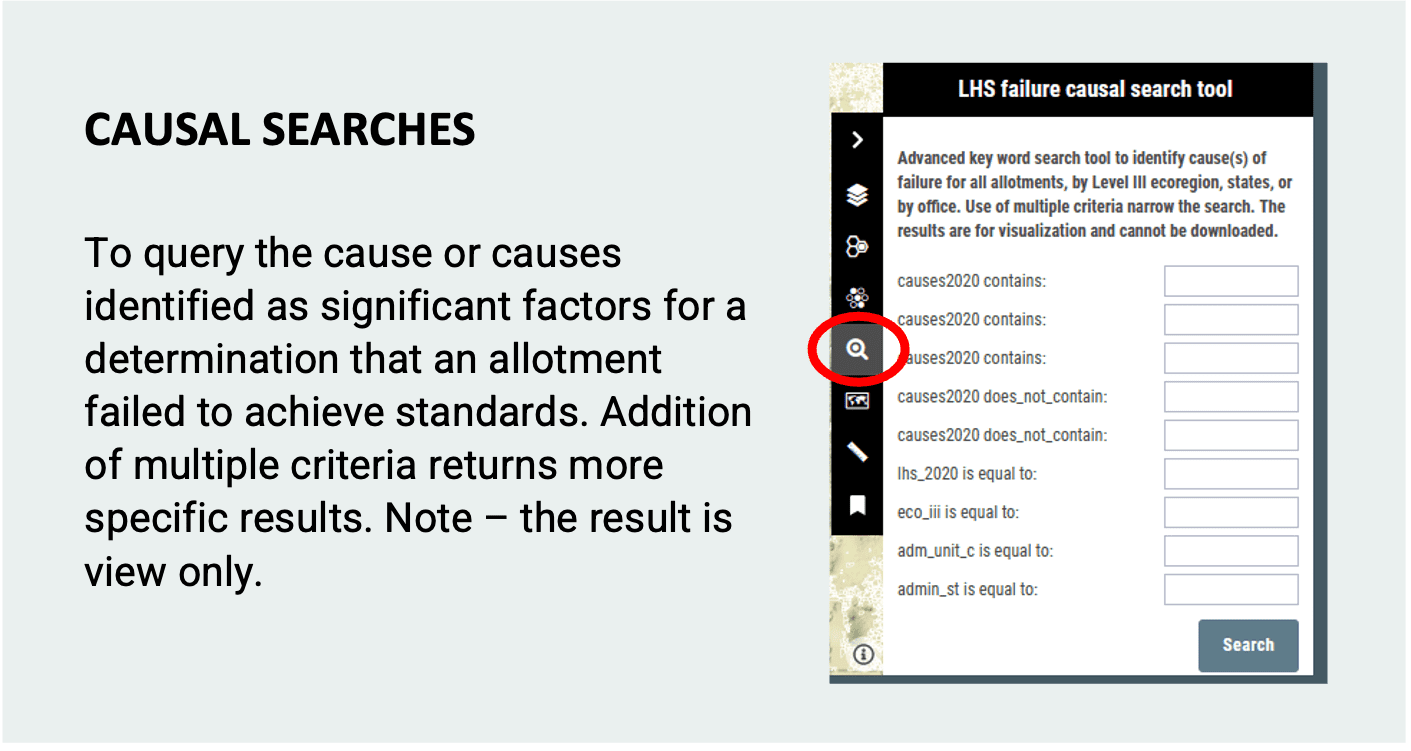
- Quick data searches identify specific words wherever they occur within any of the datasets. The more specific the phrase the more targeted the search, such as the name of an allotment, an allotment ID number (concatenation of State and Allotment Number). There are many allotments with the same name.
- Attributes for queries have internal code names present in the geodatabase. Some are intuitive, others not. Please review the Data Dictionary or the layer metadata for attribute names and descriptions.
- Unlike queries, the results of searches cannot be downloaded.
- Queries take longer to return results than searches, ranging from less than a minute to a few minutes.
- Queries within a single layer are useful for identifying specific allotments that meet specific conditions, such as all allotments within Nevada that fail to meet land health standards where livestock were recorded as a significant cause.
- Queries between two layers identify specific criteria in areas of overlap, such as identify all TerrADat plots that are within Nevada in allotments that have not had a land health standards evaluation since the program’s inception in 1997. These data may provide an opportunity to assess the conditions of plots within the allotments at the time of the field sampling and help identify the degree to which plots depart from reference conditions.
- Some queries between two layers are too complex or time out. Try narrowing the search to fewer attributes, or geographically by state, ecoregion, Field Office, or within a bounding box. All these options are available in the query box.
An example of a multi-layer query with potential management implications:
“Identify Greater Sage-grouse Breeding Bird Density areas (25%) “touch” the Cold Deserts Level II Ecoregion.”
The output represent areas with the highest density of breeding birds across the range that are within an ecoregion with among the highest failure levels associated with livestock grazing, perhaps a high “at-risk” populations.”
7. Can I download the data?
Absolutely. All data layers can be downloaded as GIS shapefiles. While some layers cannot be included in queries, but the results of queries can be downloaded as csv, GIS shapefiles for further spatial analyses, or as kml files. The kml files are very useful for examining the condition of allotments more closely and for identifying trends in conditions over time in Google Earth to answer the question – does damage caused by livestock appear to be recovering, stable, or getting worse through time? Very important information.
In addition, customizable maps can be made on the fly and downloaded by the User.
The map portal is publicly accessible, and no login is required
Please read the Disclaimer
Rangeland Map News
FOR RELEASE | March 14, 2022
 Agency Records Paint Bleak Picture of Western Landscape
New Map Shows Harmful Impacts of BLM Livestock Grazing Program




 Agency Records Paint Bleak Picture of Western Landscape